Rome's Ancient Google Maps
Visiting the Museo della Forma Urbis
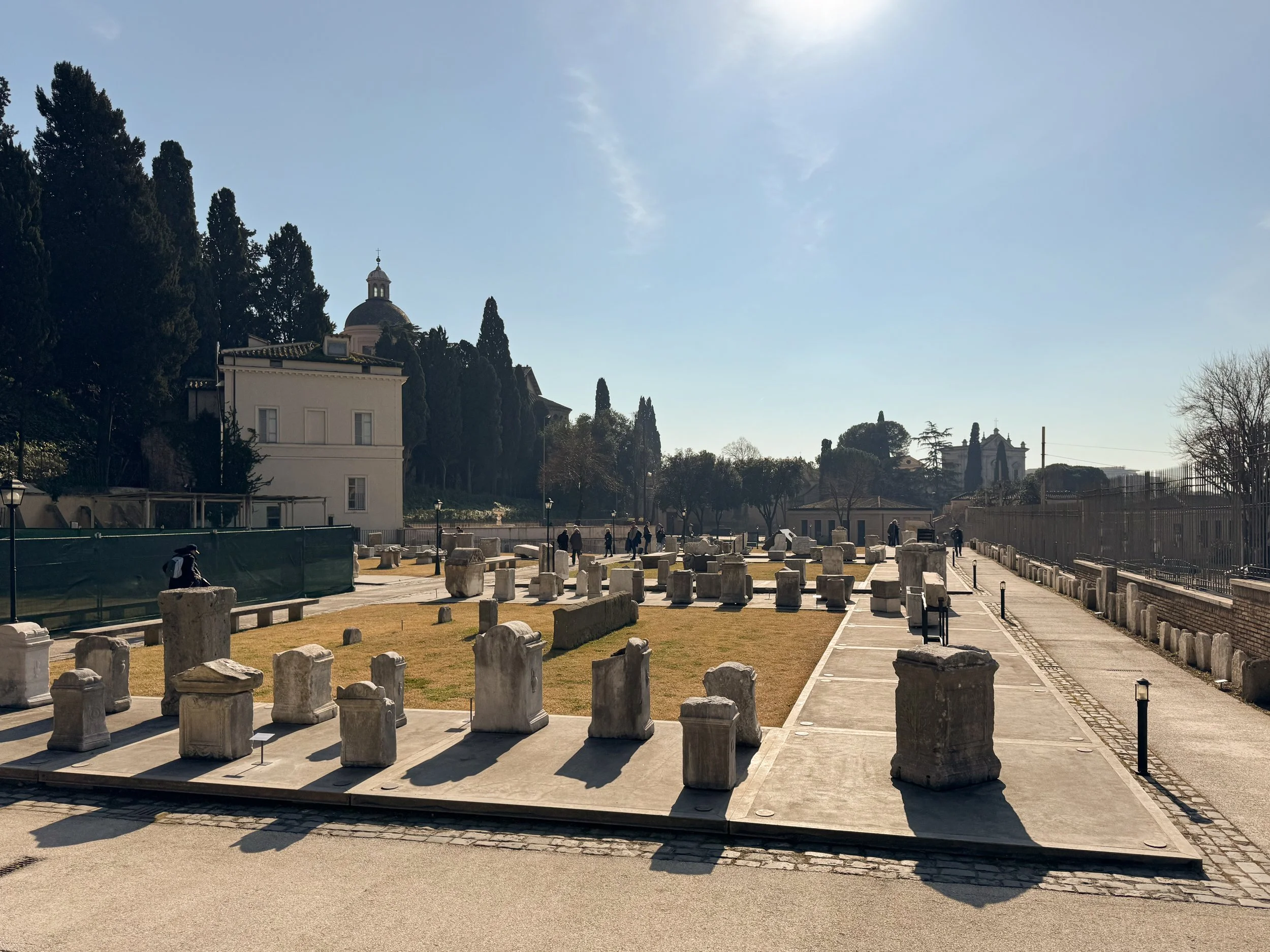
There are plenty of museums in Rome filled with famous sculptures, glittering mosaics, and spectacular frescoes. Then there's the Museo della Forma Urbis, where the star attraction is... a map.
Not just any map, though. The Forma Urbis Romae is one of the most extraordinary archaeological documents to survive from the ancient world. Imagine an enormous marble plan of imperial Rome, carved with astonishing precision nearly 1,800 years ago. It wasn't tucked away in an archive or made for scholars. It was displayed on a wall for all to see, proclaiming the grandeur of the capital of the Roman Empire and outlining its remarkable size.
If you enjoy Roman archaeology or have ever wished you could wander through ancient Rome with a bird's-eye view, this small museum is well worth adding to your itinerary. Located in the Parco archeologico del Celio, this is an easy addition to a day of exploring the Forum and Colosseum,
The original Forma Urbis was commissioned during the reign of Emperor Septimius Severus between AD 203 and 211. Rather than depicting roads or landscapes, it recorded the footprints of buildings across the city at an average scale of about 1:240. Temples, apartment blocks, bath complexes, warehouses, porticoes, and even individual shops were carefully engraved into approximately 150 marble slabs, creating a map roughly 18 by 13 meters in size.
The map was mounted high on the wall of a large hall within the Temple of Peace, one of Rome's grand sites. Interestingly, it was probably never intended to help anyone find their way around the city. Positioned well above eye level, many of the finer details would have been impossible to read from the floor. Modern scholars generally believe it served as imperial propaganda—a monumental celebration of Rome itself and of the emperor who ruled it. The sheer scale and precision of the map demonstrated both the city's magnificence and the administrative power needed to document it so meticulously.
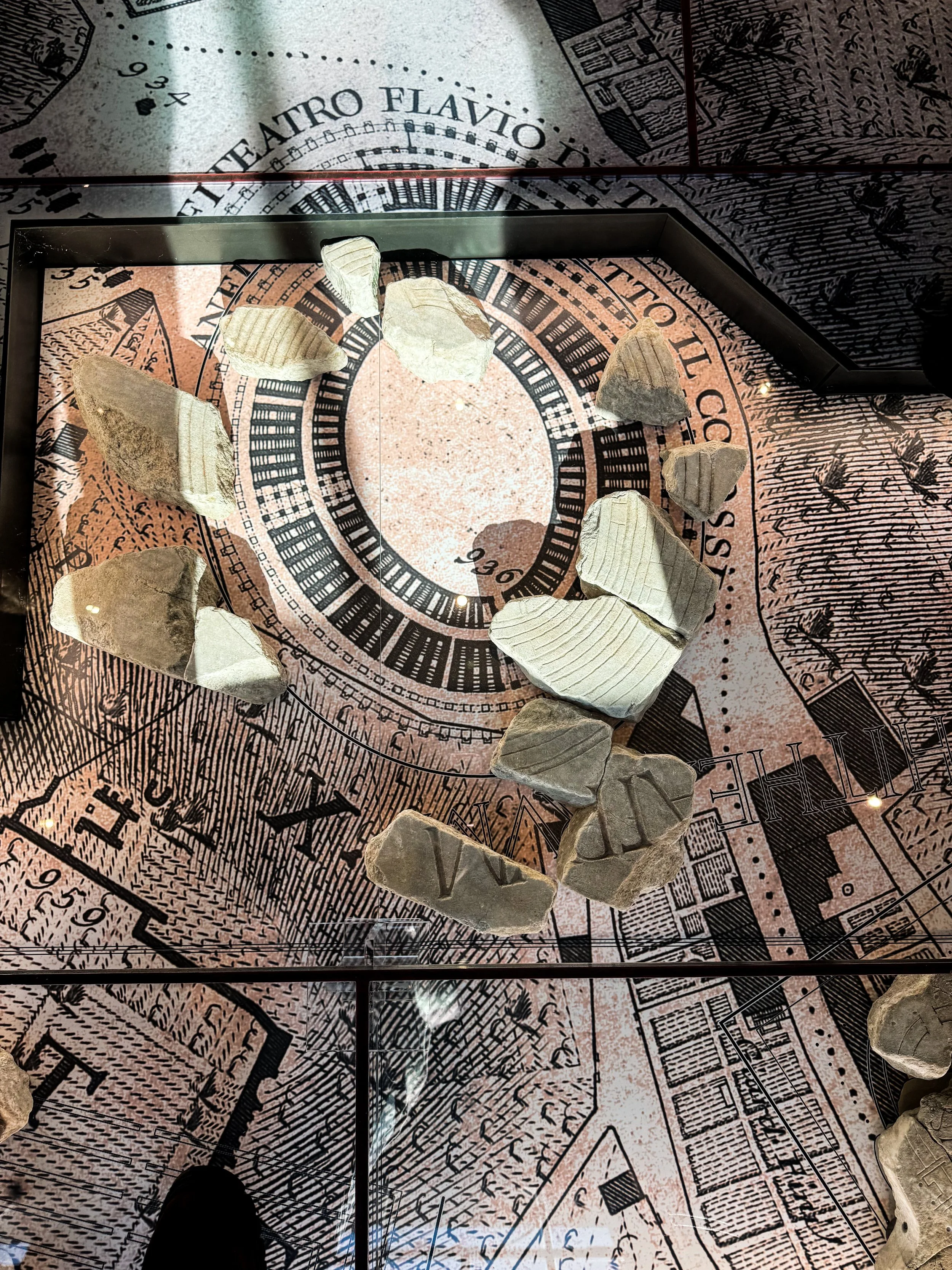
Like so much of ancient Rome, however, the Forma Urbis did not survive intact. Over the centuries, the building fell into ruin, and many of the marble slabs were removed, broken apart, or burned to make lime for new construction. In 1562, fragments started emerging during excavations around the Basilica of Saints Cosmas and Damian, which had incorporated part of the original wall of the Temple of Peace. Hundreds of pieces have since been recovered, but together they represent only about ten percent of the original map. Even so, these surviving fragments preserve an astonishing amount of information, and archaeologists have successfully identified the original location of roughly 200 pieces.
In January 2024, when Rome opened the new Museo della Forma Urbis. The museum represents the first time in nearly a century that the surviving pieces have been brought together in a dedicated space. What makes the museum especially clever is its layout. Instead of displaying the fragments in traditional wall cases, the designers placed them on the floor over Giovanni Battista Nolli's famous 1748 map of Rome. As you walk through the galleries, you can literally stand above the city and compare the surviving marble fragments with the later street plan. It becomes much easier to understand where each piece belonged and how ancient Rome relates to the modern city surrounding it.
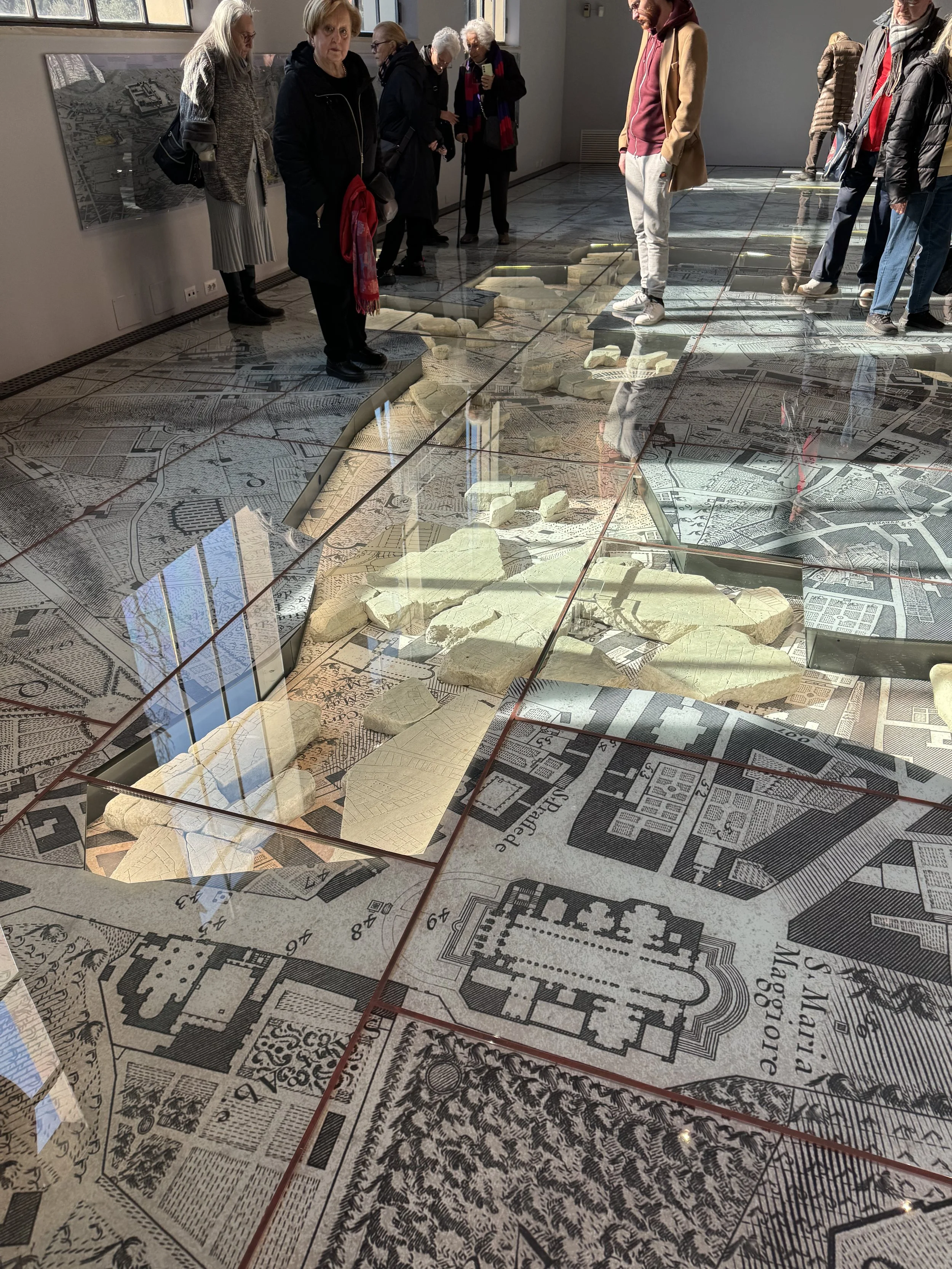
For me, the Forma Urbis is a reminder that ancient Romans didn't just build an extraordinary city, they also felt compelled to document it in breathtaking detail. Standing over those marble fragments, you're looking at something remarkably close to the city's own blueprint, carved centuries before paper maps became commonplace. It may not have helped a Roman tourist find the nearest bathhouse, but nearly two millennia later, it helps us navigate the lost city beneath our feet.